The fire belt: Mozambique's 2025 fire season
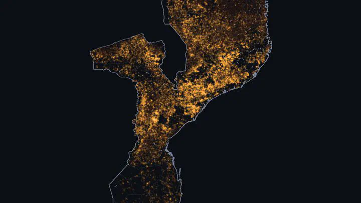 Fire detections in Mozambique, September 2025
| At a glance | |
|---|---|
| What | Every VIIRS fire detection over Mozambique in 2025 |
| Data | NASA FIRMS, VIIRS on Suomi NPP (375 m) |
| Tools | Python for processing, MapLibre and deck.gl for the full interactive map |
| Why | A side project, after “The fire belt” by Elias Omondi for the #30DayMapChallenge |
Every dry season, large parts of Mozambique burn. In 2025 the Suomi NPP satellite recorded 607,634 fire detections. Each dot is a 375 m pixel that was burning when the satellite passed over. The animation runs from May to November. Bright dots are fires from the last few days, the dark orange is everything that burned before.
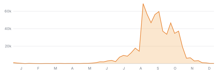
There are hardly any fires in the rainy season: December to April had about 1% of the year’s detections. Burning picks up in June and 87% of the fires were in August, September and October. Half of the year’s fires had happened by 15 September, and 90% by 25 October. They stop when the rains come back in November.
The full version is an interactive map with years back to 2012, a guided story, and layers for population, forest loss, cropland and rainfall. It is too heavy for this site (about 230 MB of data), so this page only shows 2025.