Teaching & training in Mozambique
| At a glance | |
|---|---|
| Where | Mozambique, and Wageningen for student supervision |
| When | Since 2019 |
| For | INIR (national irrigation institute), Universidade Eduardo Mondlane, the polytechnic institutes of Gaza (ISPG) and Manica (ISPM), MSc students and interns |
| Topics | Remote sensing tools, field data collection with Open Data Kit, canal flow measurement |
| My role | Trainer and supervisor |
A map is only useful if someone on the ground can work with it, check it and keep it up to date. So a part of my work at Resilience is teaching.
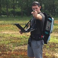
In Mozambique I have trained about 50 people. Some were GIS students, others were government staff at the national irrigation institute INIR. The topics were remote sensing tools, collecting field data with GPS and geotagged photos in Open Data Kit, and measuring how much water flows through irrigation canals.
I also supervise MSc students and interns on remote sensing topics.
Related: Saterra Labs at Resilience BV · Mapping smallholder irrigation
Authors
Geospatial analyst: satellite monitoring, change detection and machine learning